R&D · Hardware + software · Bachelor's thesis 2025–2026
A drone that goes looking for the Asian hornet's nest by itself — by following the signal of one tagged hornet, and then confirming the nest with a thermal camera.
01 · The problem
The hard part isn't catching the hornet. The hard part is finding its nest.
The Asian hornet has been spreading rapidly through Belgium since 2016. It hunts honeybees at the hive entrance, disrupts nature and is dangerous for anyone allergic to stings.
Control is only possible if you find the nest. And that's exactly the problem: in summer a colony moves to a nest 20 to 30 metres up in a treetop, invisible behind the leaves. Hornets fly kilometres from home. Today's methods — watching, setting bait traps, following on foot — are slow, exhausting and take a lot of experience.
Every week of delay counts. One unnoticed nest produces 250 new queens on average. Conservatively, that's six new nests the following year.
2021
nests found in Flanders
2022
more than five times as many
2023
the growth continues
2024
source: Vespa-Watch
“The biggest bottleneck isn't catching individual hornets, but locating their nests.”
Starting point of the project
02 · The solution
A tiny transmitter on one captured hornet calls out its own “name” every so often. The drone listens only for that name — it ignores everything else in the air.
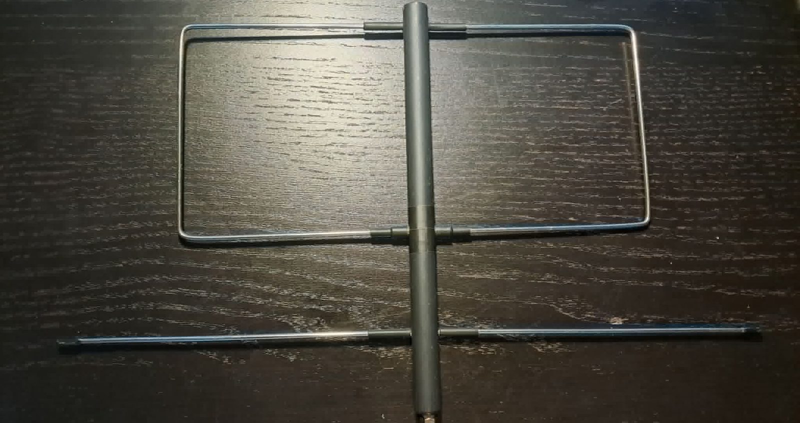
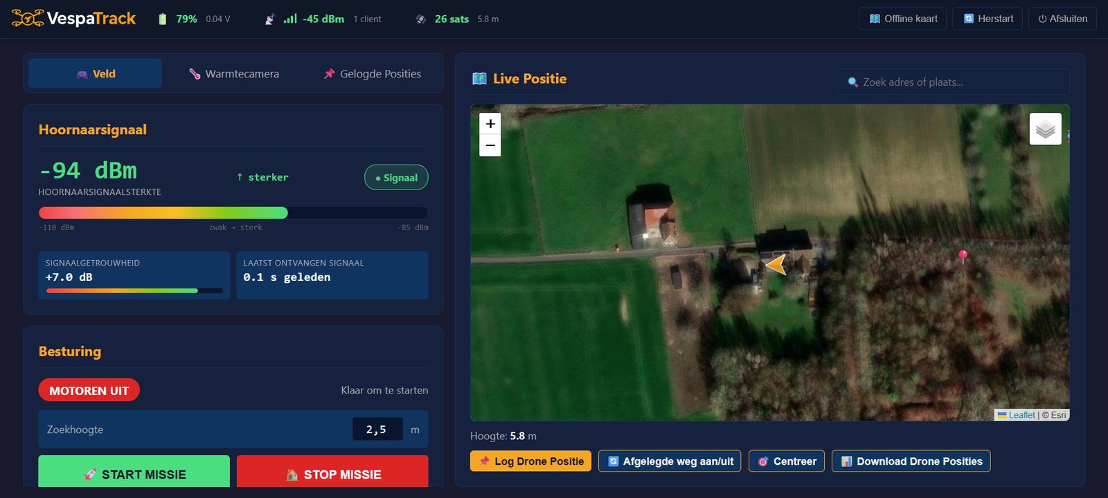
A directional antenna on board hears which side the signal is strongest. The on-board computer measures that five times a second and draws it live on a screen.
One button. The drone takes bearings in twelve directions, flies a short way that way to check the signal really does get stronger, then flies over the source and returns. Before each step it pauses briefly, so the operator can always intervene.
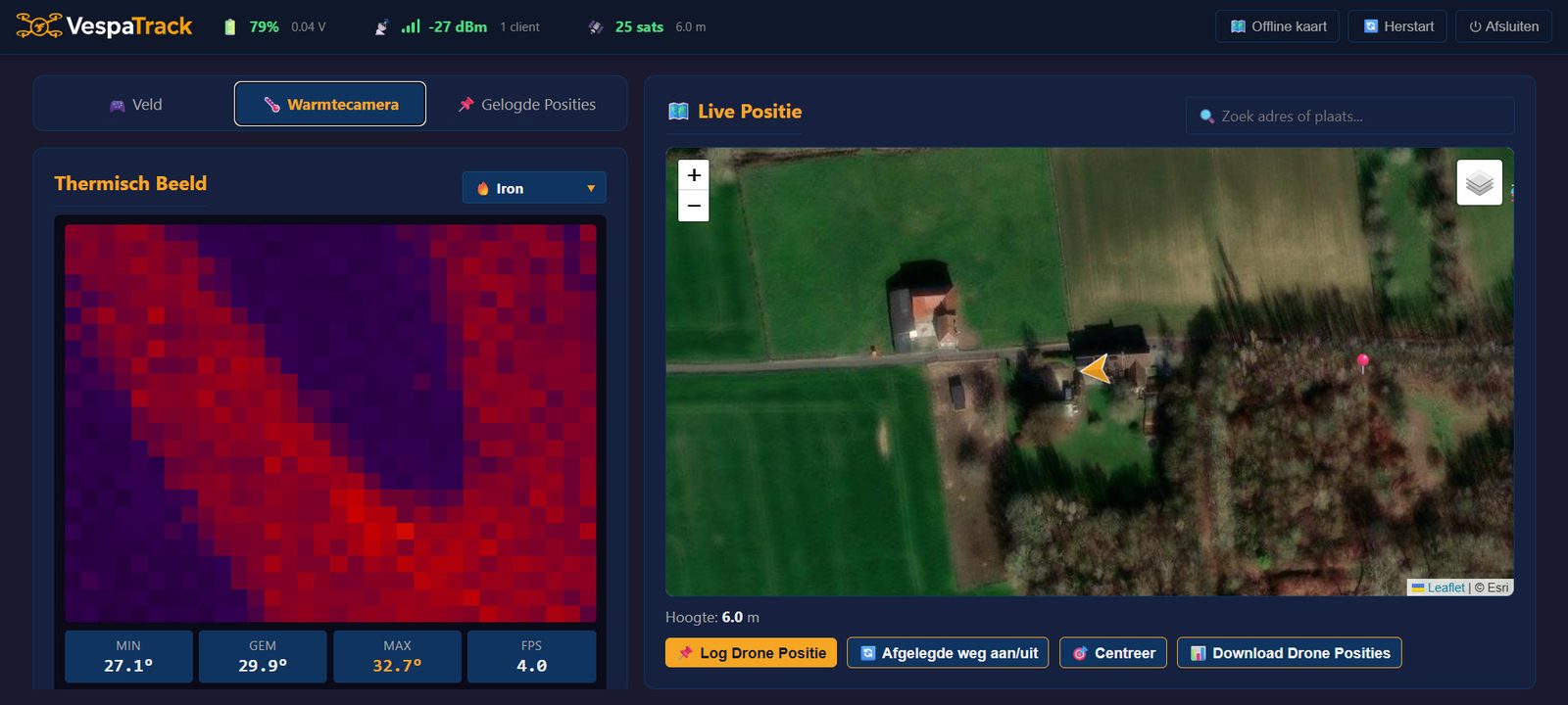
The spot goes on the map, with a confidence score. A thermal camera then shows where the nest is: an active colony is warmer than its surroundings.
The largest group in the field. Simple to operate, with live feedback on screen and the option to take control yourself.
A bigger area in less time, and locations that are immediately usable for an intervention.
Everything is logged and exportable: flight path, signal over time, thermal images.
03 · How it works
Transmitter
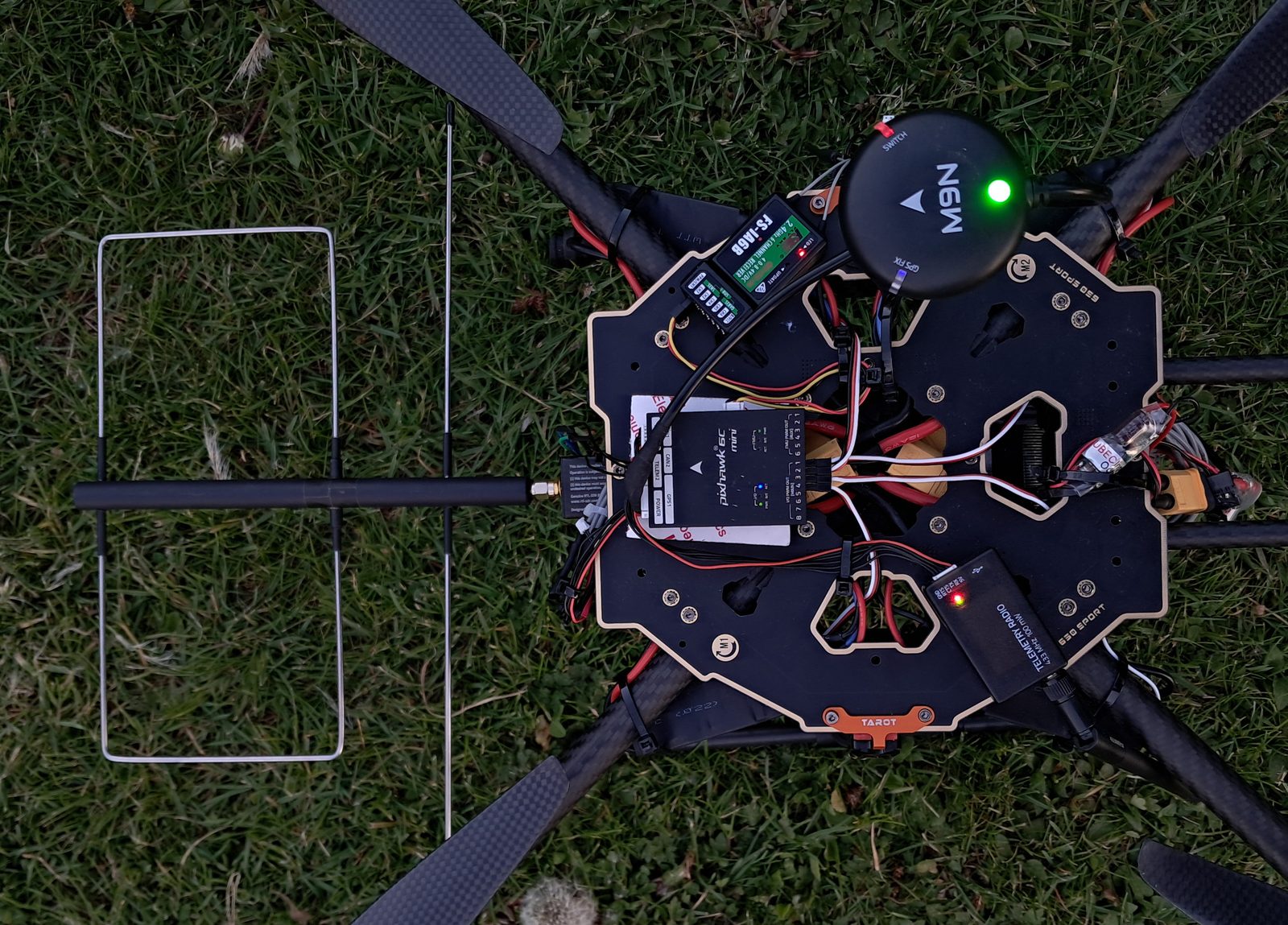
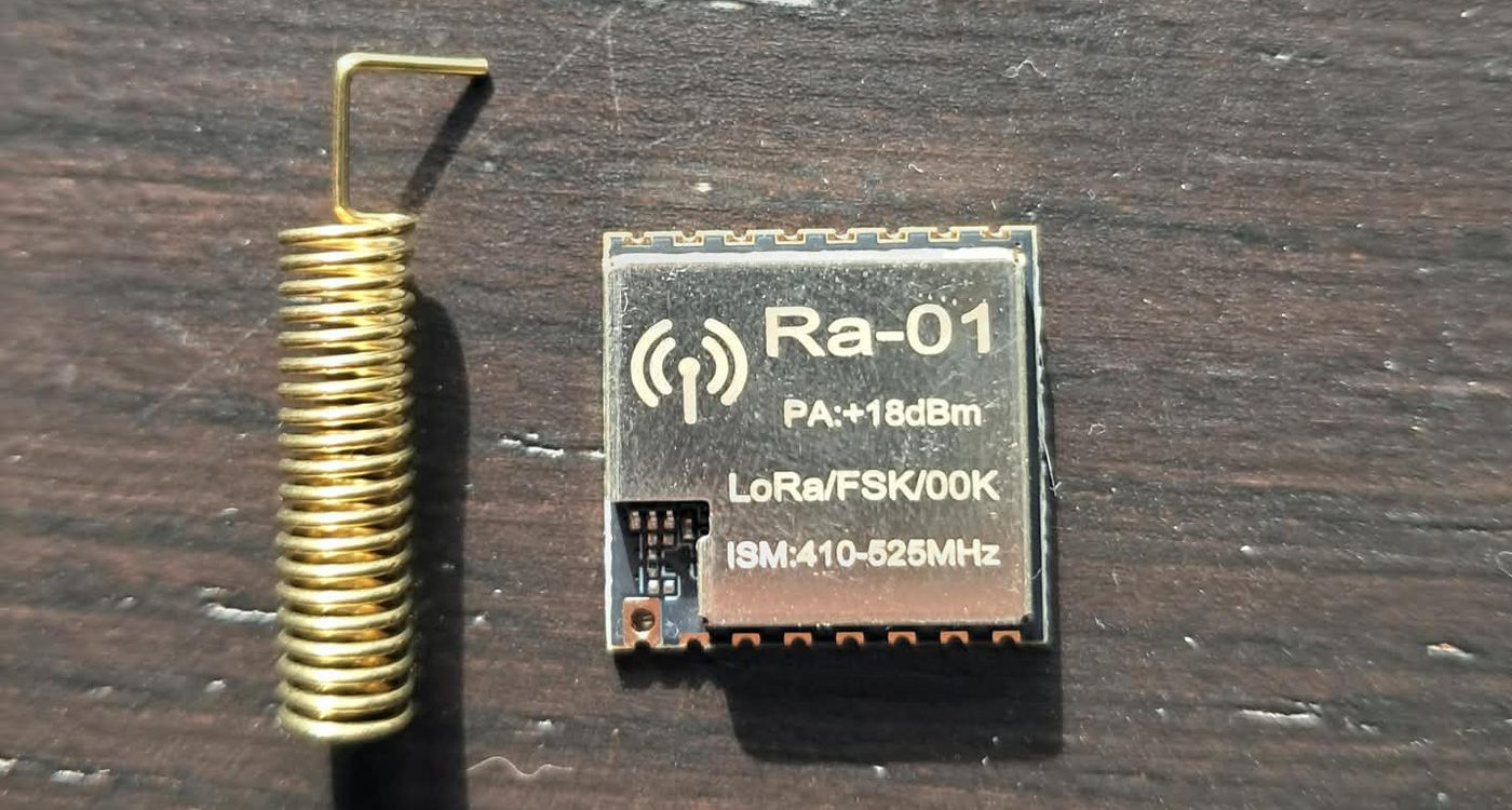
The size of a coin, with a minuscule battery. Transmits at 433 MHz — a frequency that penetrates leaves well.
Receiver
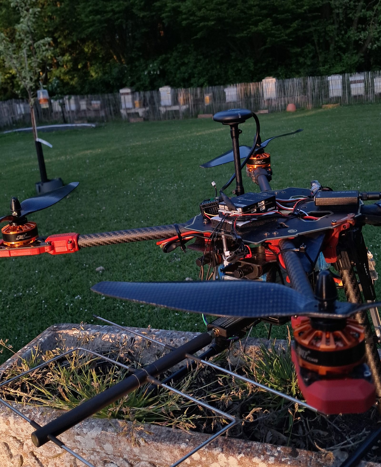
A Yagi antenna on the drone hears better in one direction than the others, like a shotgun microphone for radio waves.
Brain
A Raspberry Pi processes the signal, decides where to go, drives the thermal camera and hosts the dashboard.
Pilot
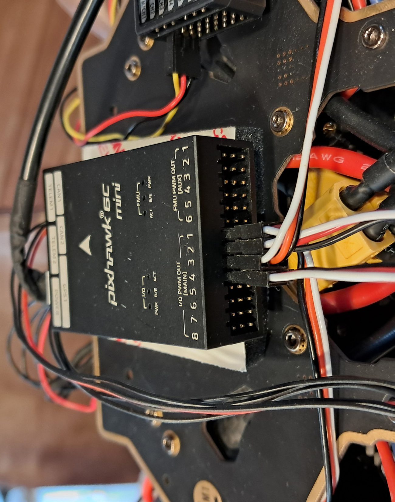
A Pixhawk keeps the drone stable in the air and carries out the on-board computer's commands. The handheld transmitter always has priority.
Result
GPS coordinates with a confidence score, ready to export to Excel.
There's no Wi-Fi in a meadow. So the drone broadcasts its own network. A laptop or smartphone connects to it and opens the dashboard like an ordinary web page. As soon as the drone gets power, everything starts by itself — no screen, keyboard or installation needed.
The first version listened to everything on the chosen frequency. Indoors that worked fine; outdoors the signal drowned in car keys, weather stations and doorbells using the same band. The second version listens only for messages with the right name. The difference was night and day — and it immediately makes it possible to track several hornets at once later on.


04 · What's inside
There's no kit for “drone + radio tracking + autonomous navigation”. So we put one together ourselves — nineteen parts, each chosen because it plays well with the rest.
05 · The dashboard
A drone that collects data is worthless without a screen that makes that data readable for a human.
Signal strength and quality as colour bars, live. No numbers to interpret — you see straight away whether you're getting warmer or colder.
Live position of the drone and the path flown, on maps downloaded in advance. Click to record a nest location with status and note — the address is looked up automatically. Export to Excel or open in Google Maps.
Live image from the thermal camera, with a colour palette of your choice and the lowest, average and highest temperature on screen.
The screen shows what the drone is about to do in each phase, with a short pause before every move. You set the search altitude yourself — poplars reach 30 to 50 metres.
The drone hovers for five seconds and checks vibration, motor balance and rotation. If something's off, it lands immediately and says why. Four times it refused to set off — each time the aircraft turned out to be genuinely faulty.
If the operator switches mode on the handheld transmitter, the mission stops immediately and everything measured so far is kept.


06 · The insight
The most obvious algorithm didn't survive the meadow. What we learned from that is broader than this project.
The plan was simple: move step by step towards where the signal gets stronger, the way you walk towards a sound in the dark. On 2 August, after two steps, the drone was less than three metres from the transmitter, with the strongest signal of the whole flight. And then flew 21 metres away.
The cause wasn't what the textbooks predict. A weakening signal simply doesn't tell you whether you're walking past it or have just gone over it. Worse: the difference between two steps was smaller than the natural fluctuation of the signal itself. The drone was steering on noise. And no smarter calculation can extract information from a measurement that doesn't contain it.
So we didn't change the algorithm, but what we measure. The drone now flies straight over the transmitter in one smooth movement. The moment it passes over, the signal dips sharply — and that moment is unmissable. Then it flies the same line back, so any lag in the measurement cancels itself out. Faster, simpler and more reliable.
| Step by step | Fly-over & cross back | |
|---|---|---|
| What does the drone steer on? | a small difference between two steps | a sharp dip when passing over |
| Clearly above the noise? | no | yes, comfortably |
| Measurements per metre | 0,2 | 4 |
| Does it know when it has passed? | no | ja |
| Duration of a search pass | ± 70 seconds | ± 30 seconds |
“First check whether what you measure is bigger than your measurement error, before you go looking for a better algorithm.”
The lesson — broader than this project
07 · Tested with real users
The dashboard was put in front of two professional Asian hornet controllers twice, both also beekeepers. No explanation beforehand, thinking aloud, no help when they got stuck. That's the only way to see what a screen tells you by itself.
They understood the structure immediately, and worked out the principle — stronger signal means closer to the nest — by themselves. The problems were in the presentation, not the functions. In the second round: “much better than last time”, “everything at a glance”.
The sharpest insight came from their own work: most search time goes into determining a hornet's flight direction again and again. So the value isn't in replacing their method, but in speeding up the slowest step in it.
“Best to have everything on one screen, so you don't have to scroll.”
Rearranged the dashboard into tabs — the essentials now fit on one screen.
Abbreviations like SNR and dBm mean nothing to us.
Replaced jargon with plain words, including in the status bar at the top.
Colour works more intuitively than numbers.
Signal strength and quality got a colour bar, scaled to what is actually measured.
Poplars reach 30 to 50 metres — tree height determines how high you search.
Made the search altitude adjustable from the dashboard.
They looked for the export button next to the list of positions, not under the map. And “Drone path” meant nothing to anyone.
Added the button where they looked for it; renamed the function to Route flown.
08 · Where it stands
09 · What it taught us
The individual parts weren't the hard bit — making them work together reliably was.
The on-board computer received data from the flight controller, but couldn't send commands back — over any cable or radio. We didn't magic it away, but bypassed it with a direct USB connection. That workaround carried the whole field campaign, and is neatly documented.
Three small mistakes in wiring and settings made the drone try to correct a tilt with the wrong motor — and so tilt harder. Then another month of puzzling until it hovered rock steady.
The first receiver heard everything on the chosen frequency. Indoors that seemed to work; outdoors the signal got lost among all the other devices. Switching to messages with their own name was no longer an option, but a necessity.
One motor spun at a touch of throttle, another only at forty percent. Adjusting by hand made it worse. In the end we tuned the threshold in the flight controller step by step until all four started together.
The flight controller talks over one serial line. As soon as two components listened at the same time, they stole each other's messages and commands got lost. Now there's one central "postman" that alone reads and delivers replies neatly to whoever asked.
With hardware, a forgotten part costs weeks, not minutes. Since then we order spares along with everything else and check the full parts list before the first soldering iron warms up.
10 · What's next
The aircraft is currently being rebuilt based on everything the first version taught us.
The cheapest intervention with the biggest payoff: it determines both how accurately and how far the drone can take bearings.
So far the beacon has transmitted at minimum power. At full power the search area becomes many times larger.
In late autumn, when the contrast is at its maximum. After that: have the nest recognised automatically in the image.
To search at greater, unknown distances too — that's where the more advanced calculation methods do come in handy.
Dense forest, several sources of interference, a moving target.
The drone can also follow transmitters from other systems. Complementary to those searching on foot — not competition, but reinforcement.
A shared map on which pest controllers claim and follow up nest locations — with the necessary access control and privacy protection.
Hardware, AI or research?